The First Map to Show the Full East-West Extent of the United States and to Give Visual Expression to the Notion of Manifest Destiny

John Melish
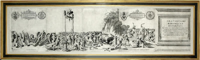
Map of the United States with Contiguous British &
Spanish Possessions
Copperplate engraving with original hand color
Engraved by J. Vallance and H.S. Tanner
Philadelphia: John Melish, June 16, 1820
43 1/2" high x 56 1/2" long
43 1/2" high x 56 1/2" long
Retail price: $125,000

There are eight
identified states of the 1820 edition. Except for the first state, which is
incomplete, most of the midifications are in the Latin American regions. The
first two states are designated as “Entered according to Act of Congress the
6th day of June 1820.” The date on the other six states is “the 16th day of
June 1820.” The present map is the fourth state, illustrated by the
modification to the lower southwestern corner statistical table: its total
population now reads 18,629,903 whereas the previous edition read 81,629,903.
 Reference: A la Carte Selected Papers on Maps and Atlases
compiled by Walter W. Ristow Geography and Map Division, Library of Congress,
Washington, 1972
Reference: A la Carte Selected Papers on Maps and Atlases
compiled by Walter W. Ristow Geography and Map Division, Library of Congress,
Washington, 1972 John
Melish was a highly educated Scottish merchant who settled in Philadelphia in
1811, eventually to become one of the first great cartographers on the American
continent. Melish drew on a number of
official state maps to produce this mammoth map of the United States, which was
used on several occasions to determine boundary lines between the U.S. and
Mexico. He first published it in 1816,
updating it frequently over the following several years as new discoveries came
to light. Melish died in 1822 and his
plates were then used by James Finlayson to bring out this new state in 1823, a
map that is a classic in the history of American mapping. This great wall map is coveted by collectors,
for it was the first to depict the United States potentially stretching from
Atlantic to Pacific, thereby embodying the nascent notion of "Manifest
Destiny." Furthermore, it demonstrated
a remarkably precise understanding of American geography, for the travel
accounts of Zebulon Pike, Lewis & Clark, Thomas Nuttall, and William Darby
were used as soon as they appeared.
Walter Ristow, the legendary historian of the mapping of America, could
not heap enough praise on this map. He
considered it "a significant milestone in the history of American
commercial cartography," and wrote that "Melish played a foremost
role in bringing together from many and varied sources the geographical and
cartographical knowledge of the period, and presenting it systematically and
graphically for the edification and enlightenment of the citizens of the young
republic."
John
Melish was a highly educated Scottish merchant who settled in Philadelphia in
1811, eventually to become one of the first great cartographers on the American
continent. Melish drew on a number of
official state maps to produce this mammoth map of the United States, which was
used on several occasions to determine boundary lines between the U.S. and
Mexico. He first published it in 1816,
updating it frequently over the following several years as new discoveries came
to light. Melish died in 1822 and his
plates were then used by James Finlayson to bring out this new state in 1823, a
map that is a classic in the history of American mapping. This great wall map is coveted by collectors,
for it was the first to depict the United States potentially stretching from
Atlantic to Pacific, thereby embodying the nascent notion of "Manifest
Destiny." Furthermore, it demonstrated
a remarkably precise understanding of American geography, for the travel
accounts of Zebulon Pike, Lewis & Clark, Thomas Nuttall, and William Darby
were used as soon as they appeared.
Walter Ristow, the legendary historian of the mapping of America, could
not heap enough praise on this map. He
considered it "a significant milestone in the history of American
commercial cartography," and wrote that "Melish played a foremost
role in bringing together from many and varied sources the geographical and
cartographical knowledge of the period, and presenting it systematically and
graphically for the edification and enlightenment of the citizens of the young
republic."
No
nation ever existed without some sense of national destiny or purpose. The notion of Manifest Destiny revitalized a
sense of "mission" or national destiny for many Americans. The term was first coined by a democratic
leader and influential editor by the name of John L. O'Sullivan, who wrote:
"....
the right of our manifest destiny to over spread and to possess the whole of
the continent which Providence has given us for the development of the great
experiment of liberty and… of self government entrusted to us. It is right such as that of the tree to the
space of air and the earth suitable for the full expansion of its principle and
destiny of growth."
Although
O'Sullivan spoke these words in the 1840s, he summed up a sense of destiny that
had its origins several decades earlier and found its first true visual
expression in Melish's great map.
Already in the early 1820s, the people of the United States felt it was
their mission to extend the "boundaries of freedom" to others by
imparting their idealism and belief in democratic institutions to those who
were capable of self-government. But
there were other forces and political agendas at work as well. As the population of the original thirteen
colonies grew and the U.S. economy developed, the desire and attempts to expand
into new land increased. For many
colonists, land represented potential income, wealth, self-sufficiency and
freedom. Expansion into the western
frontiers offered opportunities for self-advancement. The idea of Manifest Destiny became the torch
that lit the way for American expansion.
Melish's
map was produced just as the notion of Manifest Destiny was crystallizing in
the general American consciousness, and it gave visual expression to the
glorious fate that was anticipated for the young nation. Recognizing the seemingly endless demand for
geographical information on the American West, Melish undertook to accumulate a
vast amount of descriptions, statistics, and maps. Published just after Melish's death, this
edition shows the alterations made in 1820 when he enlarged the size of the map
to show the West Indies and all of southern Mexico. For the Texas area, Melish relied heavily on
the surveys conducted by William Darby, who had personally surveyed much of the
Sabine River area. Melish's map
significantly improved the descriptions and depictions of the Texas interior,
but even more significant is its official association with the Adams-Onis
Treaty. Also called the Transcontinental
Treaty of 1819, the Adams-Onis Treaty was one of the critical events that
defined the U.S.-Mexico border, and Melish's map was the main one consulted by
negotiators.
Perhaps
its most lasting value to history, however, is its depiction of the young
nation stretching from coast to coast.
This exceptional map was Melish's most noted accomplishment, a
compelling testament to the irresistible pull that Manifest Destiny -- then
purely hypothetical -- exerted on the American consciousness.
On June 9, 2004 a Melish Map of the US from 1816 sold at Christie's, New York for $83,650
An 1816 also sold at Christie's, New York on June 19, 2007 for $66,000
On June 9, 2004 a Melish Map of the US from 1816 sold at Christie's, New York for $83,650
An 1816 also sold at Christie's, New York on June 19, 2007 for $66,000

Comments
Post a Comment