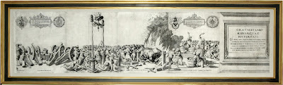
A fine engraved map of the area surrounding Fiji

DUDLEY, Sir Robert
(1574-1649). Isole Scoperte da Iacomo le Maier Olandese nel 1617. La
Longitudine Comincia da l'Isola de Pico d'Asores d Asia. Carta XXI. [Florence:
Francesco Onofri, 1646-1647.].
$4,800
Single sheet (20 4/8 x 16 inches, full margins showing the
plate mark). A fine engraved map of the area surrounding Fiji to the north and
east by Antonio Lucini, decorated with an elegant compass rose and two-masted
ship, with cursive script and the title in a decorative cartouche lower left.

A simple and beautiful chart from Dudley's "Dell'arcano
del mare", featuring several South Pacific islands located within the
northern Tongan Island group of Tongatatapu situated east of Fiji as well as
some islands in the Wallis and Futuna group situated north of Fiji. "These
particular islands were discovered by Dutch explorers Jacob le Maire and Willem
Schouten on their 1615-1616 voyage westward from Tierra del Fuego. Their
further discoveries included notably Cocos Island [i.e. Tafahi in Tongatapu] on
9th May 1616, and Verraders Island [i.e. Niuatoputapu] just to the south, and
to the northwest Good Hope Island [i.e. Niuafo'ou], then sailing further
north-west to Hornsche Island [i.e. Alofi] and then Horne Island [i.e. Futuna,
both in the Horn Islands, part of the Futuna and Wallis islands group] on 18th
May, where they were cordially received by the natives" (National Library of Australia).
Although sighted by Abel Tasman on his voyage of 1643, Fiji
was not charted properly until Captain Bligh's epic journey of 3,618 nautical
mile in a small open boat to Timor after the mutiny on the Bounty in 1789.
Robert Dudley's "Secrets of the Sea" is "ONE
OF THE GREATEST ATLASES OF THE WORLD and one of the most complex ever produced:
it is the first sea-atlas of the whole world; the first with all the charts
constructed using Mercator's new projection, as corrected by Edward Wright; the
first to give magnetic declination; the first to give prevailing winds and
currents... the first to expound the advantages of "Great Circle
Sailing"; and ... the first sea-atlas to be compiled by an
Englishman..." (Lord Wardington).

Comments
Post a Comment